Place City Locations
Learning Goal: I can accurately place a location on the city map.
Intro
Rangers are often sent to specific locations. In emergencies, quickly finding or communicating a location can make a big difference in reducing harm or increasing care. Understanding the layout of Black Rock City is the most fundamental knowledge for those goals, as your partner or your phone will not always be able to make up for you missing basic facts. This section will discuss some of the lesser-known names that are important for navigating and communicating your location as a Ranger.
Sections of the Map
The Burn is broken into two main parts: the City and Open Playa. Open Playa is further broken up into three major parts: the Inner Playa (the space within the city circle), Outer Playa (temple and beyond), and Deep Playa (by the trash fence). The entire Burn is also surrounded by a fence with 5 points (with Point 1 being the alternate exit to the highway and Point 5 being the airport).
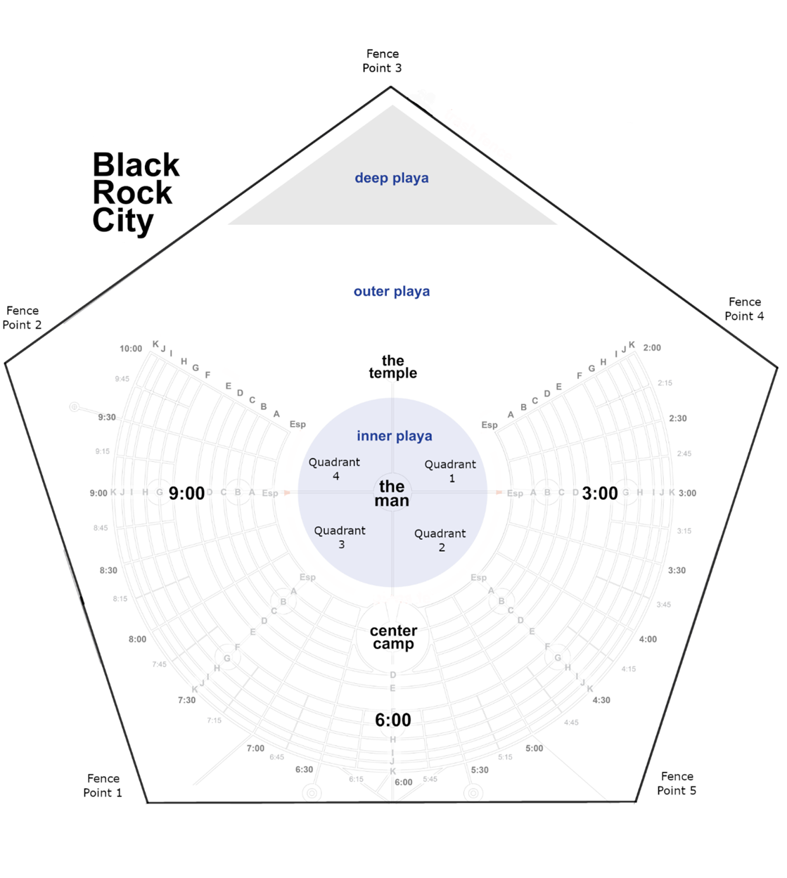
Inner Playa is also broken into four minor sections (Quadrant 1 to 4), which is useful when not being able to name a specific location or for certain roles like burn perimeter. Memorize these names so you can successfully communicate locations with all Rangers.
 Open in New Tab
A blank map where learners drag-and-drop these terms onto the correct location.
Road Names
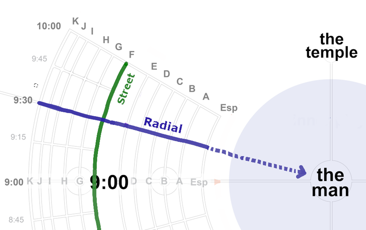
Using the specific names of the city roads can speed up communication and keep information clear. The straight roads are called Radials and are numbered (starting at 2:00 on the east side and ending at 10:00 on the west side). The curved roads are called Streets, whose names are words that change every year, but whose first letter is always in the same letter order (Esplanade, then A up to J). This means you only have to remember the first letter of the Street you're working with.
 Open in New Tab
Find the location of the intersection you are given. Practice as many times as you'd like.
Partial Roads
Being able to give good address estimates is important both in speed of communication and for when camp addresses are not available. When between numbered Radials, remember that these are named using clock timings, so the distance between two different hours (e.g., 9:00 and 10:00) is broken up into 60 units. So right before you get to 10:00, you are at 9:59. Being halfway between 9:30 and 10:00 is 9:45. And getting ¼ the way from 9:30 to 10:00 is about 9:37. See image below.
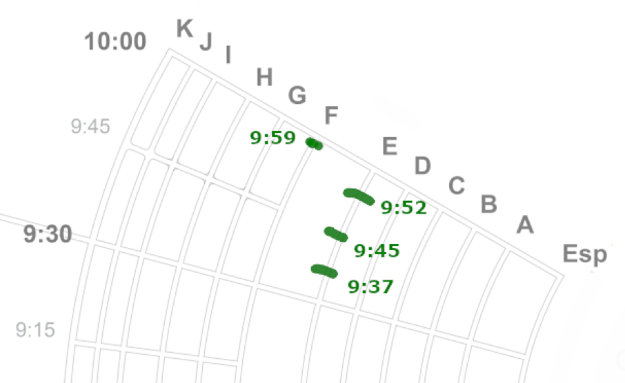
When you are in a location between two Street letters, we state these as fractions, such as "halfway up A" or "¾ the way up A" (up meaning these are between A and the higher letter B).
Note: Please notice that between Streets F and K there are Radials every 15 minutes (e.g., Radial 9:45), rather than every 30 minutes that happens for the inner City and Esplanade. See image above. Experienced Rangers have noted that when they forget this in deep parts of the City, they often turn at the wrong Radial.
Sides of a Street
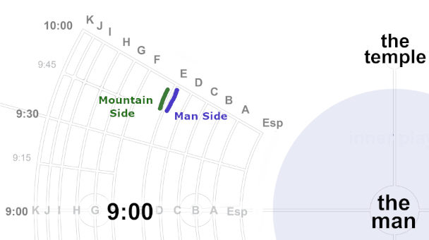
Distinguishing a specific side of a Street (aka a lettered road) is useful for many situations, such as resources finding you through heavy crowds and dust storms or determining what direction you're walking. Man-side refers to the side of the Street that is closest to the Man, which is the direction of going to lower Street letters (C → B → A) and Inner Playa. Mountain-side is the opposite, towards the bigger letter Streets (A → B → C).
Promenade
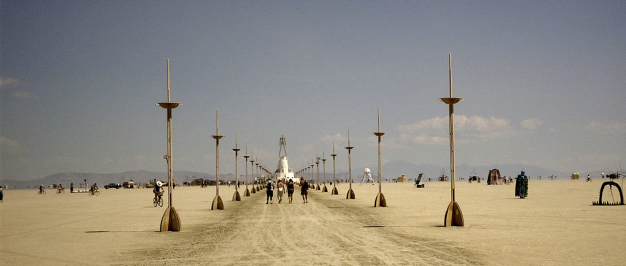
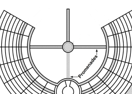
Another major feature of the Playa are the promenades, the four paths in Inner Playa that are lined with spires and have lights at night. As these are always on the 3:00, 6:00, 9:00, and 12:00 radials, they are a great way to keep track of where you are. As the 6:00 promenade has 4 lanterns per spire and the other promenades only have two lanterns, this is a great way to know which way you're going at night, especially when the Man has already burned down.
Emergency Locations
Locations that are good to have memorized for emergencies: Ranger HQ at 6:31 and Esplanade. Medical and Ranger Outpost Tokyo at 9:00 and C. Medical and Ranger Outpost Berlin at 3:00 and C. Rampart (the main Medical station) at 5:15 and Esplanade.
Test Yourself
Open in New Tab
You are given information on a position (e.g., 3:45 and G on the Man side) and must place it on the correct part of the map. Practice as many times as you'd like.