Determine City Location
Learning Goal: I can determine my position and direction in the city when missing information.
Intro
Between moments of chaos and just forgetting what you were doing, sometimes Rangers need to figure out their location and direction based on the pieces of information they do have.
Street Markers
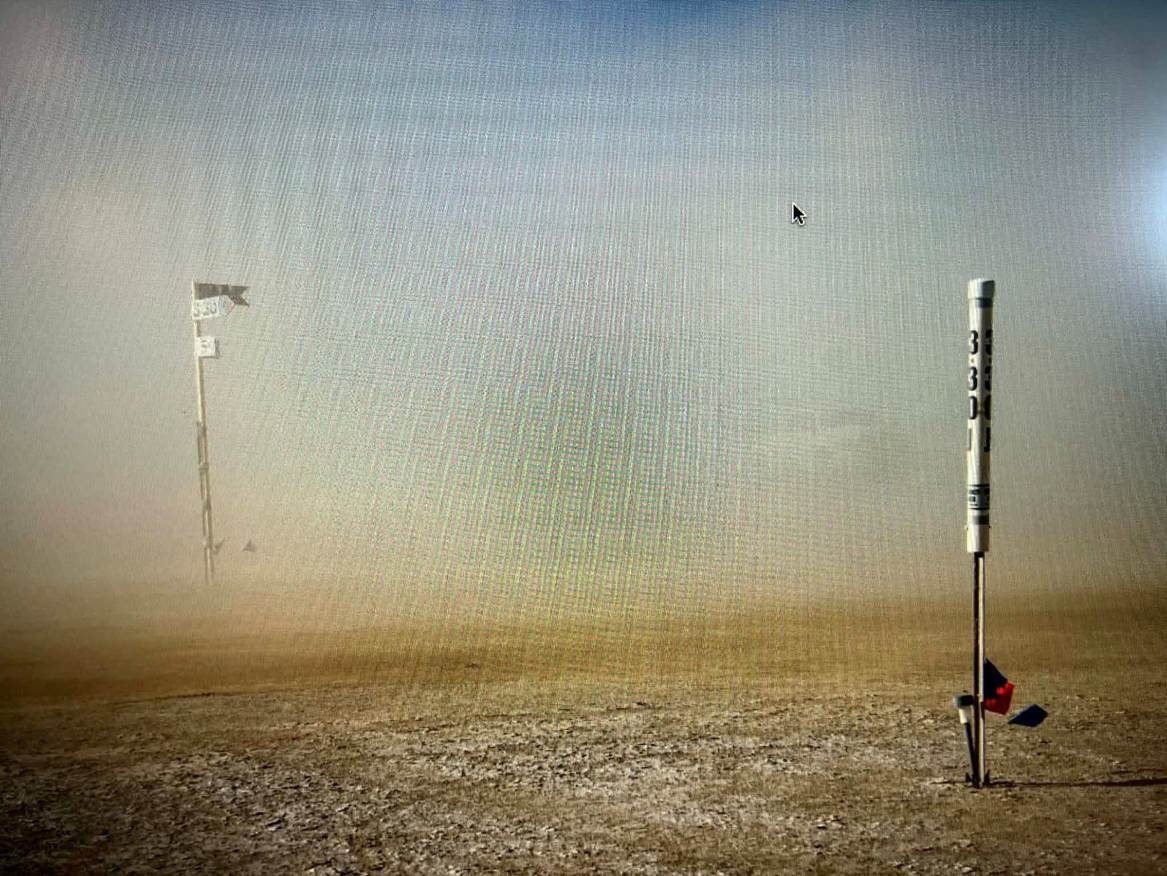
While signs at intersections are put up every year, they are also often stolen. However, intersections also have white PVC markers with the intersection written on them. Keep this in mind whenever the normal signs are missing. (Note: one city block this year may have a new system being tested out, but most of the city will have the PVC markers.)
Man Side = Direction
Man and Mountain side refer to which side of the road is closest to the Man or the Mountains. If you know which side is Man Side as you walk down a road, you know your direction (and vice versa). The most basic fact to memorize: when going towards lower number radials (i.e., 10:00 → 9:30), your left side is the Man Side. Or: Lower, Left, Man.
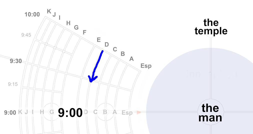
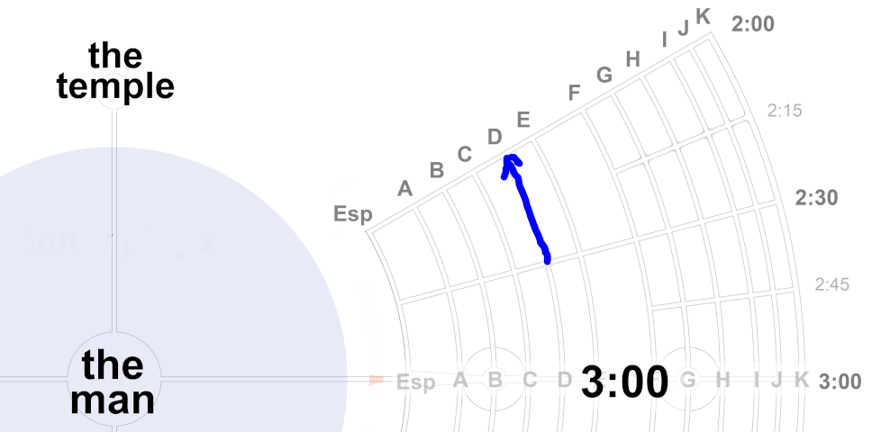
From that fact you can determine everything else. When going to higher number radials, Man Side is your right side. If the Man is on your right side, you're going towards higher number radials.
 Open in New Tab
You are given your last two locations, then asked which side of the road is Man Side. Feedback given for right, wrong, and almost-right answers.
Open in New Tab
You are told which side is Man Side, and asked if the radials to your left are higher or lower. Feedback given in text and with a map.
You can also sometimes simply see where the mountains are. An advanced skill some Rangers use is to learn what the three mountains look like and use that to determine what area they are close to. While not expected of anyone, know that this may be an option for you in the future.
Curve = Direction
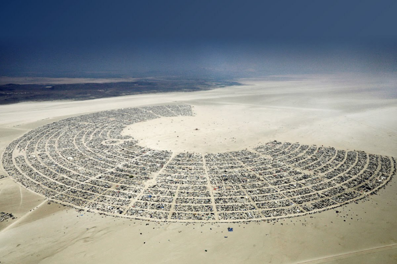
When on the deeper outer streets of the city, the curve of the street may be visible enough to be used to determine the Man Side, giving you your direction. The lettered Streets always curve towards Man Side. See image below for an example.
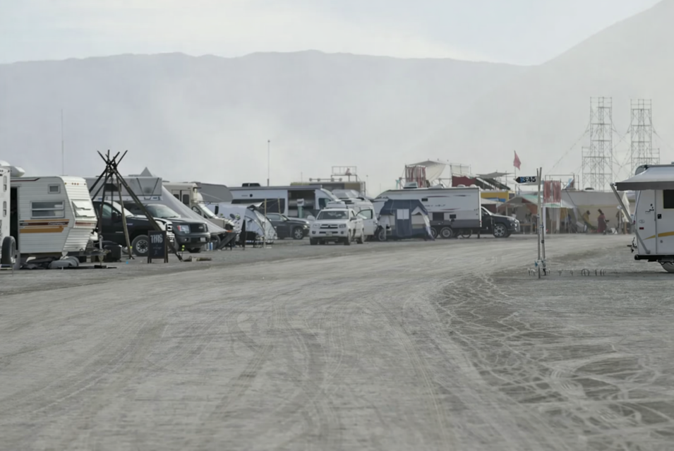
This means when facing the inside of the Street curve, you know to your left are higher number radials and to your right are lower number radials (not counting when sitting at Center Camp).
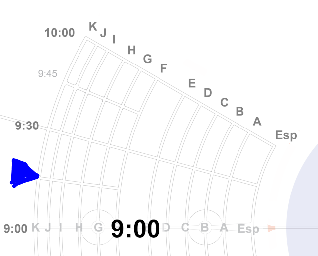
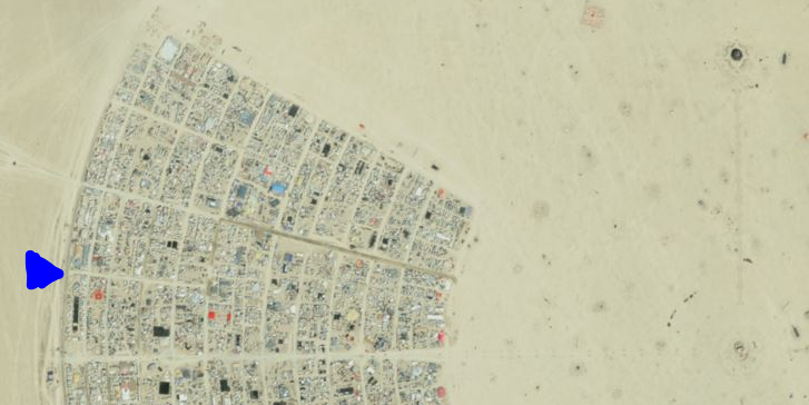
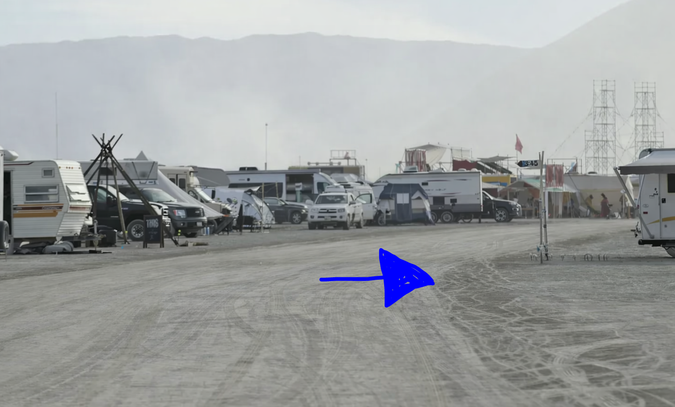 Open in New Tab
You will be shown a picture of a road with a curve. Choose if it's Man side vs Mountain side and get feedback.
Block Distances
Here are some numbers that may be useful for estimating your travel progress:
- Street C is about 433 yards / meters a block (halfway Esplanade to Man).
- Street F is about 600 yards / meters a block (¾ from Esplanade to Man).
- Street K is about 800 yards / meters a block (almost the full distance from Esplanade to Man).
Test Yourself
Open in New Tab
You are given pieces of information (curve of road, last location, broken sign, etc.) and must place your current location and direction on the city map.
Open in New Tab
You are placed on a map with no road labels. Travel to the correct location only knowing your current intersection and which side is Man side. This is a harder version of Wayfind 1, as now your knowledge of Man Side and direction is what keeps you on course. Use the arrow keys to navigate.